This 2009 report of Glengarry resources gives details of the drilling done in the Folly area as shown on the AZY map. Combined with this, Geoview and Google earth I have come up with some images for the Colt Folly area for which further research can be done.
2009 Glengarry report

Location and Assay data
Assay for bottom of hole BOH
Location
The Glengarry 2009 report summarises the work done up to that time.

A majority of the deeper drilling was done at Magnum but I have focussed on trying to work out what drilling was done near Folly and Colt.
This map should be reasonably accurate for the drill hole location and bottom of hole copper assays in the Folly area.

Some google earth images of the area - there are some grid discrepancies for the holes thus treat the maps as schematic rather than accurate for hole locations.

Drill ready combined geophysical and geochemical anomaly?
Surface cover and Permian fluvio glacials probably make surface geochem near useless so the above map with BOH Cu values at the basement contact? represent the available geochemistry apparently. Light blue lines are approximate depths to basement based on aircore drilling and perhaps some AEM interp.

Aircore drill spacing is generally 5+-Kms and gives local basement geochem.
Relatively large magnetic anomaly near ANK 118 but low EOH Cu etc.
ANK 119 has elevated? Cu at 192ppm associated with a strong magnetic trend and perhaps some stratigraphy. The remaining widespaced aircore holes have low Cu values away from Colt.
Rio's input based on drilling they have done?? to the NW could add to targetting in this area.
There are AEM, IP and multiple magnetic surveys available as well.
e.g colt drilling based on IP

Colt Area.
Two diamond holes drilled in 2004 - follow up to aircore Cu trace Au?? Hole location accuracy questionable but there does appear to be traces of ground disturbance on the image.

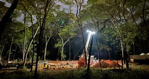
I included these google earth images to give an idea of what access and logistics will be like for the Folly area. The sand dunes are not easy to cross and I suspect there are severe environmental requirements about not disturbing them or associated fauna/flora.
The track above shows how much extra and potentially difficult travel can be needed for access. NGM's 2004/5 program had some problems with both access and drilling that needs to be considered by the JV IMO. Translates into extra time and effort to get results to the market.

This 2009 report of Glengarry resources gives details of the...


Add to My Watchlist
What is My Watchlist?
